The US virgin Islands as seen from ESA’s Sentinel-2 satellite on 23rd August 2017. Pre-storm imagery like this is used to compare to post-storm images in order to spot major changes.
Irma has brought widespread devastation to many islands in the Caribbean over the last few days, and now Hurricane Jose is a growing threat in the same region.
By analysing images of the stricken areas captured by ESA’s Sentinel-2 satellites, Zooniverse volunteers can provide invaluable assistance to rescue workers. Rescue Global are a UK-based disaster risk reduction and response charity who are deploying a team to the Caribbean and will use the information you provide to help them assess the situation on the ground.
The last time The Planetary Response Network was brought online was to help in the aftermath of the 2016 Ecuador Earthquake. Back then over two thousand volunteers helped analyse almost 25,000 square kilometres of satellite imagery in only 12 hours, and we hope to be of help this time too!
Right now we have limited clear-sky images of the affected area, mostly around Guadeloupe, but we are working hard to upload images from the other islands as soon as possible.
Very soon after the recent magnitude-7.8 earthquake in Nepal, we were contacted by multiple groups involved in directly responding with aid and rescue teams, asking if we could assist in the efforts getting underway to crowdsource the mapping of the region. One of those groups was Rescue Global, an independent reconnaissance charity that works across multiple areas of disaster risk reduction and response. Rescue Global also works with our collaborators in machine learning here at Oxford, combining human and computer inputs for disaster response in a project called Orchid. And they asked us to help them pinpoint the areas with the most urgent unfulfilled need for aid.
And so we sprang into action. The satellite company Planet Labs generously shared all its available data on Nepal with us. The resolution of Planet Labs’ imagery – about 5 metres per pixel – is perfect for rapid examination of large ground areas while showing enough detail to easily spot the signs of cities, farms and other settlements. After discussions with Rescue Global we decided to focus on the area surrounding Kathmandu, with a bias westward toward the quake epicentre, as much of this area is heavily populated but we knew many other, complementary efforts were focusing on the capital itself. We sliced about 13,000 km2 of land imagery into classifiable tiles, and created a new project using brand new Zooniverse software (coming very very soon!) that allows rapid project creation.
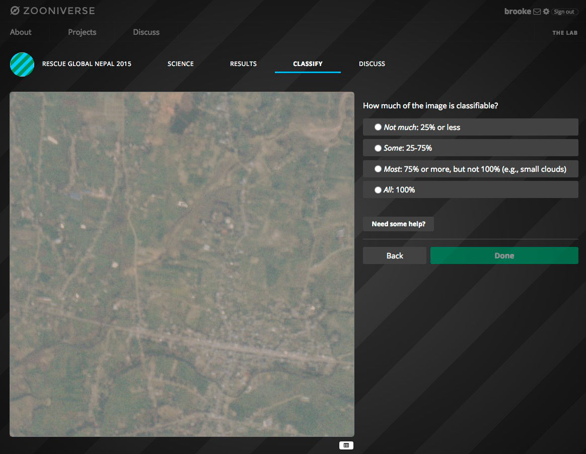
Once we had prepared the satellite images, we created the project in less than a day. Users were asked to indicate the strength of evidence of settlements in the area, and then how much of the image was classifiable.
We also realised that if we combined our work with the results of some of the aforementioned complementary efforts, we needn’t wait for the clouds to part so that we could get post-quake images. For example, the Humanitarian OpenStreetMap Team (HOT) is doing brilliant work providing exquisitely detailed maps for use in the relief efforts. But here’s the thing: Nepal is pretty big (larger than England). And accurate, detailed maps take time. So in the days immediately following the earthquake, our area of focus – which we already knew had been severely affected – hadn’t been fully covered by HOT yet. And by comparing rapid, broad classifications of a relatively large area of focus with the detailed maps of smaller areas provided by HOT efforts, we could still make very confident predictions about where aid would most be needed even with just pre-quake images.
Because our images were in the sweet spot of area coverage and resolution, we were able to classify the entire image set in just a couple of days with the combined effort of only about 25 people, comprising students and staff members from Oxford and Rescue Global staff. For each image, we asked each person about any visible settlements and about how “classifiable” the image was (sometimes there are clouds or artefacts).
After the classifications were collected, the machine learning team applied a Bayesian classifier combination code that we first used in the Zooniverse on the Galaxy Zoo: Supernova project. After comparing these results with the latest maps from the HOT team, we saw two towns that were outside the areas currently covered by other crisis mapping, but that our classifiers had marked as high priority.
Maps from OpenStreetMap (left) and satellite images from Planet Labs (right) for 2 regions in Nepal. The top area shows the Kathmandu Airport (already well mapped by other efforts) and the bottom shows a town southwest of Kathmandu that, at the time of Rescue Global’s request to us, had not yet been mapped.
We passed this on to Rescue Global, who have added it to the other information they have about where aid is urgently needed in Nepal. The relief efforts are now in a phase of recovery, cleanup, and ensuring the survivors have the basic necessities they need to carry on, like clean water and food. Now they are coping with the damage from the second earthquake too.
Those on the ground are still busy providing day-to-day aid, so it’s early days yet to properly characterise what impact we may have had, but the initial feedback has been very good. We will be analysing this project in the days and weeks to come to understand how we can respond even more rapidly and accurately next time. That likely includes much larger-scale projects where we will be calling on our volunteers to help with classification efforts. We believe the Zooniverse, Planet Labs, and partners like Rescue Global and Orchid (and QCRI, our partner on other in-the-works humanitarian projects) can make a unique and complementary contribution to the humanitarian and crisis relief sphere. We will keep you posted on the results of our Nepal efforts and those of other, future crises.
PS: This activity was carried out under a programme of, and funded by, the European Space Agency; we would also like to acknowledge our funders for the current Zooniverse platform as a whole, principally our Google Global Impact award and the Alfred P. Sloan Foundation. And, to our team of developers who worked so hard to make this happen: you rock.
The world's largest and most popular platform for people-powered research. This research is made possible by volunteers—millions of people around the world who come together to assist professional researchers.